

Johns Island · Kiawah · Seabrook · Wadmalaw
The islands’ history
From 4,000-year-old shell rings to the churches freedpeople built, the Civil War on River Road and how the resorts came to be. Every line links to where it came from — and where the sources disagree, you get both.
Last verified
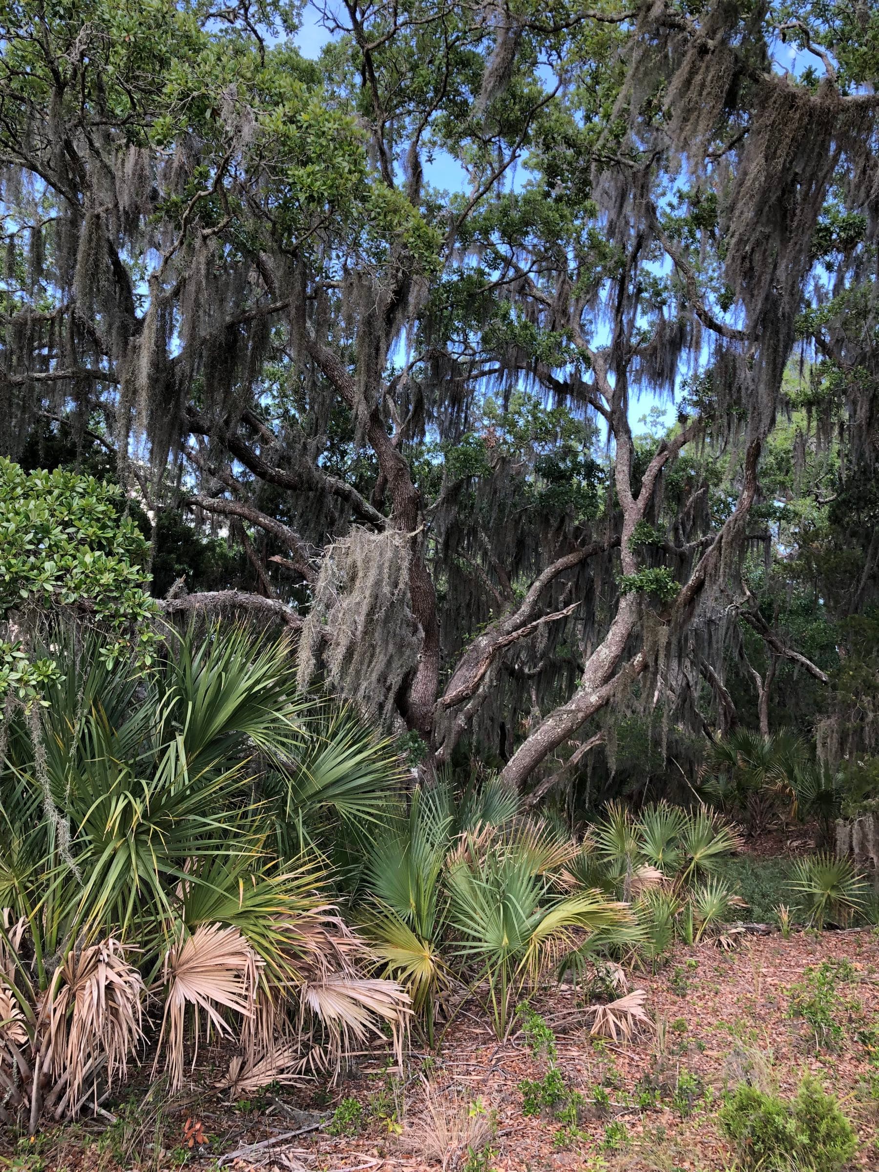
Photo: chucka_nc, CC BY-SA 2.0, via Wikimedia Commons (resized)
The stories, told in full
Johns Island · Wadmalaw
Gullah Geechee on the islands
The language, freedpeople and the land, the praise houses and the churches they built.
Read it →1861–1865
The Civil War on Johns Island
Robert Blake’s Medal of Honor, Haulover Cut, “Bloody Bridge” and the fort under the airport.
Read it →3688 Angel Oak Road
The Angel Oak’s real story
Who owned the land, what the tree meant to the Gullah community, and its honest age.
Read it →The farms
The Johns Island tomato
Sea Island cotton to truck farming, the crews who did the work, and where to buy now.
Read it →
The first peoples
Before 1670
People lived on these islands thousands of years before Europeans came: the shell rings on Wadmalaw are about 4,000 years old, and Kiawah’s Bass Pond site about 3,800. At contact, the records name these nations.
Kiawah
Tied to the Ashley River in Spanish records of the late 1500s and friendly to the English, they moved to the island that bears their name in the early 1680s. They are last mentioned in 1743. Charleston County Public Library
Stono
The people of the Stono River. Those who resisted the English in 1674 were sold into slavery in the Caribbean; a 1682 pamphlet counted only 16 Stono hunters. Charleston County Public Library
Edisto
Visited by William Hilton in 1663 and Robert Sandford in 1666, when their chief was a woman. Their villages had a large round council house thatched with palmetto. SC Encyclopedia
Kussoe (Cussoe)
Centered on the upper Ashley, they resisted from 1671 and were forced from their homelands in 1675. The Angel Oak nomination says Kussoe leaders conveyed Johns Island land to English investors. Charleston County Public Library · National Register (SC SHPO)
Bohicket
First appear on a map of about 1685; little else is recorded. Their name is on the creek, the road and the marina. Charleston County Public Library
- A Spanish-led raid in 1686, epidemics from 1697 to 1706 and the Yamasee War of 1715 broke the coastal nations; by 1770 the lieutenant governor wrote that they had disappeared. Survivors were often absorbed into inland nations. Charleston County Public Library · SC Encyclopedia
- “Cusabo,” the name often used for them, is a later scholars’ label with thin evidence behind it — the peoples didn’t call themselves that. Charleston County Public Library
- Their languages faded from South Carolina by the mid-1700s but left their names on the map: Kiawah, Stono, Edisto, Abbapoola. SC Encyclopedia · Charleston County Public Library
Island by island
A dated timeline for each island. Pick one.
Johns Island
- 1600sAt European contact the Stono, Bohicket and Kussoe (Cussoe) peoples live on Johns Island. National Register (SC SHPO) · National Register (SC SHPO) (2)
- 1670English colonists settle at Charles Towne. Kussoe leaders convey Johns Island land to English investors, among them the Quaker planter Abraham Waight, whose grant holds the Angel Oak. National Register (SC SHPO)
- c. 1675Europeans formally settle Johns Island. National Register (SC SHPO)
- 1710The Scottish minister Archibald Stobo founds the Johns Island Presbyterian congregation; its first church follows about 1719. SC Encyclopedia
- c. 1730John Fenwick builds Fenwick Hall, a two-story brick Georgian house near the Stono. SC Encyclopedia · National Register (SC SHPO)
- 1733The colony sets up a ferry over the Stono between Alexander Hext’s plantation on Johns Island and Thomas Heyward’s on James Island. National Register (SC SHPO)
- 1734St. John’s Colleton Parish is carved out of St. Paul’s. It covers Johns, Wadmalaw, Edisto, Seabrook and Kiawah. SC Encyclopedia
- 1739The Stono Rebellion begins — on the mainland, across the river, not on Johns Island. SC Encyclopedia · National Register (SC SHPO)
- 1742The parish church is finished on Johns Island, overlooking Bohicket Creek and the Wadmalaw River. SC Encyclopedia
- By 1770River Road is complete in its C-shaped route; it and Bohicket Road both appear on a 1770 map. National Register (SC SHPO)
- 1779–1780British troops camp along River Road from Fenwick Hall to Stono Ferry; in 1780 Clinton’s army marches across the island toward Charleston. National Register (SC SHPO) · SC Encyclopedia
- 1787John Gibbes buys Fenwick Hall and adds an octagonal wing. National Register (SC SHPO) · SC Encyclopedia
- 1822–23Today’s Johns Island Presbyterian Church is built, with an upper gallery where enslaved people worshiped. SC Encyclopedia
- 1849–50An inventory of Angel Plantation lists 29 enslaved people; a year later the Angel family holds 97 on Johns Island. National Register (SC SHPO)
- 1863–64The Battle of Legareville (Christmas 1863), Haulover Cut (February 1864) and Burden’s Causeway, “Bloody Bridge” (July 1864). Fort Trenholm goes up late in 1864. Naval Historical Center · Johns Island Conservancy · Post and Courier · National Register (SC SHPO)
- 1865A Freedmen’s Bureau survey finds nearly all Charleston County plantations abandoned by planters and occupied by freedpeople born on them. National Register (SC SHPO)
- 1867–1885Freedpeople organize Presbyterian congregations; Hebron Presbyterian Church is built in 1884–85. National Register (SC SHPO)
- 1893The Great Sea Island Storm strikes the southern coast with little warning; more than 2,000 people die. SC Encyclopedia
- 1911–12The ferry’s owner brings the first automobile over by flatboat; a year later the Johns Island Ferry goes bankrupt as cars catch on. National Register (SC SHPO)
- c. 1917Moving Star Hall is built on River Road. National Register (SC SHPO)
- 1920sThe first road bridges cross the Stono. In 1935 the toll comes off the Stono bridge. National Register (SC SHPO) · National Register (SC SHPO) (2)
- 1940sThe Army builds Johns Island Army Airfield during World War II — today’s Charleston Executive Airport. The FAA dates the field to April 1943. FAA record · Charleston Regional Aviation Authority
- 1957The first Citizenship School class meets at the Progressive Club; its Sea Island Center building follows in 1963. National Register (SC SHPO)
- 1959Hurricane Gracie tears large limbs from the Angel Oak; a telephone company buys the 2.1 acres around the tree. National Register (SC SHPO)
- 1989Hurricane Hugo knocks Hebron Presbyterian Church off its brick piers. National Register (SC SHPO)
- 1991The City of Charleston buys the Angel Oak parcel. National Register (SC SHPO)
- 2003–04The high bridges open: the John F. Limehouse Memorial Bridge on Main Road (2003) and the Paul J. Gelegotis Bridge on Maybank Highway (2004). Post and Courier
- 2025–26Hebron Presbyterian (2025), the Angel Oak (2026) and River Road (2026) join the National Register of Historic Places. National Register (SC SHPO) · National Register (SC SHPO) (2) · National Register (SC SHPO) (3)
Kiawah
- 3,800 years agoPeople live in a shell midden on an old dune ridge by Bass Creek — twice, about 3,800 and 2,800 years ago. The Bass Pond Site is on the National Register; its location is kept private. National Register (SC SHPO)
- Early 1680sThe Kiawah people, friendly to the English, leave their Ashley River home for the island that now bears their name. Charleston County Public Library
- 1699The Lords Proprietors deed the island to George Rayner — the Town’s history calls him “Captain Raynor.” SC Encyclopedia · Town of Kiawah Island
- 1717 & 1737John Stanyarne buys the island in two halves and clears land for indigo. Town of Kiawah Island · SC Encyclopedia
- 1743The last known reference to the Kiawah people, in an appeal for refuge. Charleston County Public Library
- c. 1770The Vander Horst House is built — one of the oldest plantation houses left on Kiawah. Who built it is disputed. National Register (SC SHPO)
- 1771–72Elizabeth Raven, a Stanyarne granddaughter, marries Arnoldus Vanderhorst; in 1772 the estate splits, the west half to Mary Gibbes and the east half to the Vanderhorsts. SC Encyclopedia · Town of Kiawah Island · SC Encyclopedia (2)
- 1794–96Arnoldus Vanderhorst, who owned 1,350 acres on Kiawah, serves as governor of South Carolina. SC Encyclopedia
- 1812Temporary naval posts go up on the northeast end to guard the Stono and Kiawah rivers. Town of Kiawah Island
- Early 1800sSea Island cotton replaces indigo and stays the main crop into the 20th century. SC Encyclopedia
- 1861–65The planter families leave the island. In February 1864 Union troops cross Kiawah and Seabrook toward Haulover Cut. After the war the Vanderhorsts acquire the whole island. Town of Kiawah Island · Johns Island Conservancy
- By 1918Hurricanes and the boll weevil end Sea Island cotton, and the fields go back to woods. SC Encyclopedia
- c. 1950C.C. Royal buys the island from the Vanderhorst family for $125,000, builds the first bridge to Johns Island and the first summer home, on Eugenia Avenue, named for his wife. Town of Kiawah Island · SC Encyclopedia
- 1974Royal’s heirs sell for $17,385,000 to Kiawah Island Company, Inc., a subsidiary of the Kuwait Investment Corporation. SC Encyclopedia
- 1976The Kiawah Island Inn and the Marsh Point course (later Cougar Point) open; the community association is founded and real-estate sales begin. Town of Kiawah Island · Kiawah Island Real Estate
- 1988The Town of Kiawah Island is incorporated, and Kiawah Resort Associates buys the island from its Kuwaiti owners for $105 million. SC Encyclopedia · Kiawah Island Real Estate
- 1991The Ocean Course opens and hosts the Ryder Cup, September 27–29; the United States wins 14½ to 13½. SC Encyclopedia
- 1993The Kiawah Island Club is founded when its Beach Club opens on Thanksgiving Day. Kiawah Island Real Estate
- 1997The Kiawah Conservancy is founded. Kiawah Island Real Estate
Seabrook
- Deep timeThe Town of Seabrook dates people on the island to as early as 1400 BC; the Kiawah, Stono and Bohicket are the peoples named in the 1600s records. Town of Seabrook Island
- 1666Robert Sandford arrives exploring for Charles II; on the same voyage he meets the Edisto people, whose chief was a woman. Town of Seabrook Island · SC Encyclopedia
- By the 1680sThe Stono people’s lands have passed to the colony by treaty. SC Encyclopedia
- c. 1753Its first owner, Thomas Jones, had named it for himself; Ebenezer Simmons buys it and it becomes Simmons Island. Town of Seabrook Island
- 1780Sir Henry Clinton’s army lands on Simmons Island on February 11–12 and marches across Johns and James Islands to besiege Charleston, which surrenders on May 12. SC Encyclopedia
- 1816William Seabrook buys Simmons Island and gives it his family name. Town of Seabrook Island
- 1861–63The Confederate Army orders the Sea Islands abandoned; in 1863 Seabrook’s children sell to the family of the textile maker William Gregg. Town of Seabrook Island
- 1864In February the Battle of Haulover Cut is fought at the channel between Seabrook and Johns Island; in July more than 4,000 Union troops march from Seabrook into Johns Island. Town of Seabrook Island · Johns Island Conservancy · National Register (SC SHPO)
- 1881–1938The Greggs sell to William Andell (1881); the Andells sell a large share to Victor Morawetz of New York (1938). Town of Seabrook Island
- 1951Morawetz gives the property to the Episcopal Diocese of South Carolina. It becomes Camp St. Christopher. Town of Seabrook Island
- 1970The diocese sells all but 230 acres to the Seabrook Island Development Corporation. Town of Seabrook Island
- 1972–81The property owners’ association forms under the developer (1972); Ocean Winds and the tennis courts open (1973), the Beach Club (1974), the Island House (1980) and Crooked Oaks (1981). Town of Seabrook Island
- 1983Graves from a burial ground at Rabbit Point Plantation, disturbed by development, are reinterred in Hebron Presbyterian’s cemetery on Johns Island. National Register (SC SHPO)
- 1987Residents vote 341 to 65 on May 19 to become a town; the certificate is issued May 26. Town of Seabrook Island · Town of Seabrook Island (2)
- 1991After the Ocean Club’s bankruptcy, about 900 owners buy the amenities and form The Club at Seabrook Island. Town of Seabrook Island
Wadmalaw & Rockville
- c. 2000 BCTwo shell rings — Hanckel Mound on Leadenwah Creek and Horse Island at Rockville — hold some of the earliest pottery known in North America. Both are on the National Register; their locations are kept private. National Register (SC SHPO) · National Register (SC SHPO) (2)
- 1686A Spanish-led raid devastates the coast from Port Royal to Edisto and Wadmalaw. Charleston County Public Library
- Colonial eraWadmalaw and Johns, with fresh water, hold most of the parish’s rice plantations; indigo grows on all its islands. SC Encyclopedia
- c. 1782John Seabrook builds a ferry, a stagecoach tavern, a road and an arched brick bridge on Leadenwah Creek — one of only two brick bridges in the Charleston area known to predate the Civil War. National Register (SC SHPO)
- 1784 / c. 18241784 is the date the Town of Rockville says is “typically given” for its founding; the National Register dates Rockville as a summer resort to about 1824, one of the county’s oldest surviving. Town of Rockville · National Register (SC SHPO)
- 1890The Rockville Regatta begins as a challenge race between the cousins Isaac Jenkins Mikell, in Mermaid, and John F. Sosnowski, in Undine. SC Living
- 1947–52The first four Sea Island One-Design sloops are built from sketches by Oliver Seabrook. SC Living
- 1963Tea plants are moved to a 127-acre farm on Wadmalaw for research. Charleston Tea Garden · SC Encyclopedia
- 1972The Rockville Historic District is listed on the National Register. National Register (SC SHPO)
- 1987–2003William Barclay Hall makes the tea farm a commercial operation (1987); Bigelow Tea buys it (2003). Charleston Tea Garden · SC Encyclopedia
- 1996The Town of Rockville is incorporated. Town of Rockville
- 2020The farm is renamed the Charleston Tea Garden, in recognition of the weight of the word “plantation.” Charleston Tea Garden
1739 and 1779
The Stono, twice — and why neither happened on the island
The Stono Rebellion
September 9, 1739
- Up to about 100 enslaved people — several of the leaders from the Kingdom of Kongo — seized arms at a store near the Stono bridge and marched south toward Spanish Florida. They were confronted near the Jacksonborough ferry on the Edisto that afternoon. About 40 white residents and probably as many Black participants died. SC Encyclopedia
- It began on a branch of the Stono in St. Paul’s Parish, on the mainland near today’s Rantowles — across the river from Johns Island, not on it. The National Historic Landmark is off US 17 on the west bank of the Wallace River; the landmark record names the leader as Jemmy, an Angolan. SC Encyclopedia · National Register (SC SHPO)
- Afterward the 1740 Negro Act tightened control over enslaved people, and a 1741 import duty followed. SC Encyclopedia
The Revolution
Stono Ferry, 1779 — and after
- June 20, 1779About 1,200 Americans under Gen. Benjamin Lincoln attacked about 900 British, Hessian and Loyalist troops under Lt. Col. John Maitland at redoubts on the mainland bank of the Stono, near today’s Hollywood. British reinforcements packed the causeway from Johns Island and helped turn the attack back. American Battlefield Trust
- British losses: 26 killed, 93 wounded, 1 missing. American: 30 killed, 116 wounded, 155 missing, many of them probably deserters. American Battlefield Trust
- Fenwick Hall served as headquarters for the invading armies’ commanders in both the Revolution and the Civil War — which is why it came through both without serious damage. National Register (SC SHPO)
- November 14, 1782At Dill’s Bluff on James Island, Kosciuszko led about 70 men; Capt. William Wilmot was killed, often called the last Continental soldier killed in the Carolinas. The survivors retreated across James Island to Johns Island. American Battlefield Trust
A 2025 National Register nomination calls Johns Island the rebellion’s “starting point.” The South Carolina Encyclopedia and the Landmark record put it on the mainland — we follow them. More in where the sources disagree.
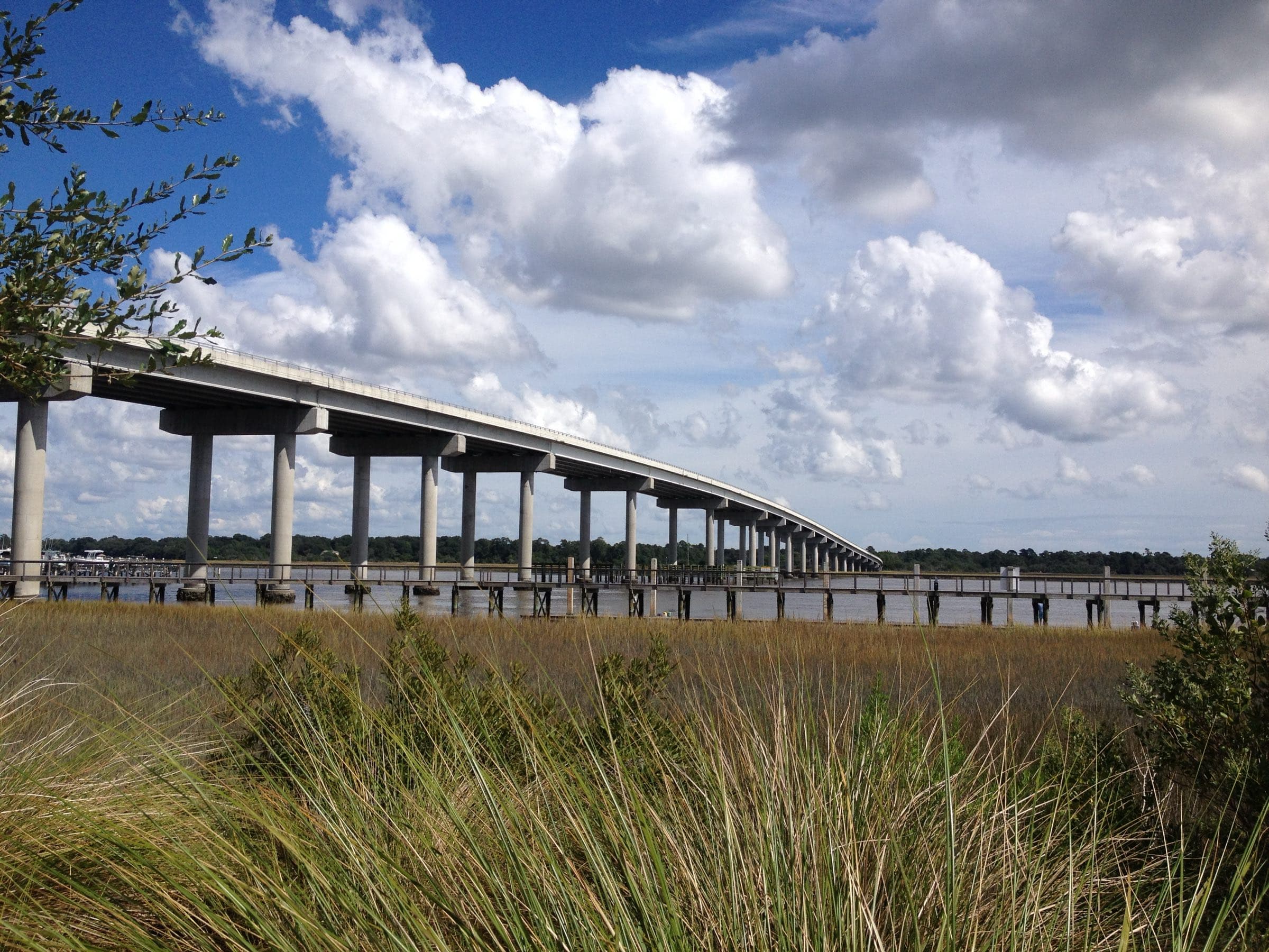
The Stono River at the Maybank Highway bridge
Photo: Cantbeatpie, CC BY-SA 3.0, via Wikimedia Commons (resized)
From ferry to bridge
For most of its history you reached Johns Island by water.
- 1733The first ferry over the Stono, between the Hext and Heyward plantations. The Stono Ferry on the island’s northwest side became the main crossing, fed by River Road and, from 1792, Chisolm Road; by 1825 it was Guerin’s Ferry. National Register (SC SHPO)
- Until the early 20th century Johns Island was “mostly inaccessible except by boat,” the Hebron nomination says. National Register (SC SHPO)
- 1911–12The ferry’s owner, Limehouse, brought the first automobile across by flatboat. A year later the Johns Island Ferry went bankrupt. National Register (SC SHPO)
- 1920sThe first road bridges. One National Register nomination says a wooden bridge on Main Road in 1921, then a creosote bridge on Maybank about 1930; another says the Stono bridge was finished in 1928 and the Limehouse bridge in 1929. Both agree: the 1920s. National Register (SC SHPO) · National Register (SC SHPO) (2)
- 1935The Rockville Route — today’s Maybank Highway — is paved and the toll comes off the Stono bridge. National Register (SC SHPO)
- c. 1950On Kiawah, C.C. Royal builds the first bridge from Kiawah to Johns Island. SC Encyclopedia
- 2003–04The John F. Limehouse Memorial Bridge ($30 million, 2003) replaces an old low swing bridge on Main Road; the Paul J. Gelegotis Bridge ($46 million, 2004) replaces the Maybank drawbridge. Post and Courier
Historic places you can see
National Register listings and county markers on and near the islands — and which ones you can actually visit.
| Place | Where | Listed | Visit |
|---|---|---|---|
| Angel Oak Johns Island | 3688 Angel Oak Road National Register (SC SHPO) · City of Charleston | 2026 | Open to visit A free City park, open seven days, closed holidays. |
| River Road Johns Island | 16.8 miles, from Main and Chisolm Roads around to Bohicket Road National Register (SC SHPO) | 2026 | Open to visit A public road — drive it. |
| Johns Island Presbyterian Church Johns Island | 2550 Bohicket Road National Register (SC SHPO) · Charleston County markers | 1975 | From the road An active church; see it from the road and the county marker. |
| Hebron Presbyterian Church Johns Island | 4058 Betsy Kerrison Parkway National Register (SC SHPO) | 2025 | From the road Seen from the parkway. |
| Moving Star Hall Johns Island | 3104 River Road National Register (SC SHPO) | 1982 | From the road Seen from River Road; treat it as private. |
| The Progressive Club Johns Island | 3377 River Road National Register (SC SHPO) · Charleston County markers | 2007 | From the road County marker 10-81 at River Road and Royal Oak Drive. |
| Fenwick Hall Johns Island | Off River Road National Register (SC SHPO) · Charleston County markers | 1972 | Not open A private home. Marker 10-119 on River Road, a quarter mile north of Maybank, is the public stop. |
| Burden’s Causeway battlefield Johns Island | River Road at Plow Ground Road Charleston County markers | Marker 2006 | From the road County marker 10-50. |
| Fort Trenholm Johns Island | Charleston Executive Airport National Register (SC SHPO) | 1982 | Not open On airport property; we found no public access. |
| Vander Horst House Kiawah | Inside Kiawah’s gate National Register (SC SHPO) | 1973 | Not open We found nothing saying the public can visit. |
| Rockville Historic District Wadmalaw | Rockville, on Bohicket Creek National Register (SC SHPO) | 1972 | From the road Public streets past private homes — look from the road. |
| Charleston Tea Garden marker Wadmalaw | 6617 Maybank Highway Charleston County markers · Charleston Tea Garden | Marker 2014 | Open to visit At the Tea Garden, which is open to visitors. |
| Shell rings and the Bass Pond Site Wadmalaw and Kiawah | Locations kept private National Register (SC SHPO) · National Register (SC SHPO) (2) · National Register (SC SHPO) (3) | 1970s | Not open Archaeological sites. |
| Stono Rebellion site The mainland | Off US 17 at the Wallace River, Rantowles National Register (SC SHPO) · Charleston County markers | 1974 (Landmark) | From the road County marker 10-48 on US 17. |
Seabrook has no National Register listing in the state’s records. Ways to spend a day among these places are on charters & excursions.
Where the names come from
- Kiawah — For the Kiawah people, who moved to the island in the early 1680s. A trace of the coastal Muskogean languages. SC Encyclopedia · Charleston County Public Library · SC Encyclopedia (2)
- Stono — For the Stono people of the Stono River. Charleston County Public Library · SC Encyclopedia
- Edisto — For the Edisto people, recorded from the 1560s. SC Encyclopedia · Charleston County Public Library
- Bohicket — The Bohicket people appear on a map of about 1685. What the word meant isn’t recorded. Charleston County Public Library
- Abbapoola — One of the Lowcountry’s hundred-plus Indigenous place names. Charleston County Public Library
- Seabrook Island — Named by William Seabrook, who bought it in 1816. Before that it was Simmons Island, and before that Jones’s. Town of Seabrook Island
- Angel Oak — For Justus Angel and Martha Waight Angel, on whose plantation it stood. National Register (SC SHPO)
- Fenwick Hall — For John Fenwick, who built it about 1730. SC Encyclopedia
- Fort Trenholm Road — For the 1864 earthwork on the airport grounds, named for George A. Trenholm. National Register (SC SHPO)
- Haulover Cut — The channel between Johns Island and Seabrook, linking Bohicket Creek and the Kiawah River. National Register (SC SHPO) · Johns Island Conservancy
- Maybank Highway — Earlier called the Rockville Route. National Register (SC SHPO)
- Betsy Kerrison Parkway — Once part of Bohicket Road. National Register (SC SHPO)
- Eugenia Avenue, Kiawah — Named by C.C. Royal for his wife. Town of Kiawah Island
- Vanderhorst — For the family that held Kiawah from 1772 to about 1950. Town of Kiawah Island · SC Encyclopedia · SC Encyclopedia (2)
Still looking for a source on: Johns Island, Wadmalaw, Rockville, Captain Sams, Betsy Kerrison, Maybank (which Maybank). Know one? Tell us — with the source, and we’ll add it.
Both sides, and which we follow
Where the sources disagree
Where the Stono Rebellion began
- One source
- The SC Encyclopedia and the National Historic Landmark record: on the mainland in St. Paul’s Parish, near Rantowles.
- Another
- Hebron Presbyterian’s 2025 National Register nomination calls Johns Island the “starting point.”
- What we print
- The mainland. The nomination’s line is an error. SC Encyclopedia · National Register (SC SHPO) · National Register (SC SHPO) (2)
When C.C. Royal bought Kiawah
- One source
- The Town of Kiawah: 1950.
- Another
- The SC Encyclopedia: 1952.
- What we print
- “About 1950,” with both dates here. Town of Kiawah Island · SC Encyclopedia
When Kiawah sold for $105 million
- One source
- The developer’s timeline: 1988.
- Another
- The Town of Kiawah’s history page: 1998.
- What we print
- 1988 — the year the Town incorporated, too. The Town page’s 1998 looks like a typo. Kiawah Island Real Estate · Town of Kiawah Island
Who built the Vander Horst House
- One source
- The National Register: built about 1770 for a Stanyarne.
- Another
- The SC Encyclopedia names John Stanyarne; the Town credits Elizabeth and Arnoldus Vanderhorst.
- What we print
- “About 1770” — the builder is disputed. National Register (SC SHPO) · SC Encyclopedia · Town of Kiawah Island
The first road bridges to Johns Island
- One source
- River Road nomination: Main Road 1921, Maybank about 1930.
- Another
- Angel Oak nomination: the Stono bridge 1928, the Limehouse bridge 1929.
- What we print
- “The 1920s.” National Register (SC SHPO) · National Register (SC SHPO) (2)
Moving Star Hall’s age
- One source
- The National Register: built about 1917.
- Another
- The SC Encyclopedia calls it an “antebellum praise house.”
- What we print
- The building is about 1917; the praise-house tradition it carries is antebellum. National Register (SC SHPO) · SC Encyclopedia
The Angel Oak’s age
- One source
- The National Register (2026): an estimated 400–500 years.
- Another
- The City of Charleston: 300–400 years.
- What we print
- 400–500, from the newer study — and never 1,000-plus. National Register (SC SHPO) · City of Charleston
The fight at Dill’s Bluff, 1782
- One source
- The American Battlefield Trust: on James Island, with the survivors retreating to Johns Island.
- Another
- The SC Encyclopedia places it on Johns Island.
- What we print
- James Island. American Battlefield Trust · SC Encyclopedia
Haulover Cut’s toll
- One source
- The Town of Seabrook: three days and 34 lives.
- Another
- The Johns Island Conservancy: February 9–11, 1864, two cadets killed, no total.
- What we print
- The dates, and the 34 credited to the Town. Town of Seabrook Island · Johns Island Conservancy
Help us find
- When the first fixed crossings reached Seabrook and Wadmalaw
- The burning of Legareville in 1864, from a primary source
- Whether any Johns or Wadmalaw land was granted under Sherman’s Field Order No. 15
- What the 1893 storm and Hugo did to each island
- Where the names Johns Island, Wadmalaw and Captain Sams came from
Have a primary source — a deed, a letter, a family record? Send it our way.
Quick answers
Did the Stono Rebellion happen on Johns Island?
No. It began on September 9, 1739, on a branch of the Stono River in St. Paul’s Parish, on the mainland near today’s Rantowles — across the river from Johns Island. The National Historic Landmark is off US 17 at the Wallace River.
How old is the Angel Oak?
An estimated 400 to 500 years, from recent studies cited in its 2026 National Register listing. The City of Charleston says 300 to 400. Claims of more than 1,000 years are unsupported.
How did Kiawah Island get its name?
From the Kiawah people, who left their home on the Ashley River for the island in the early 1680s. They are last mentioned in the records in 1743.
How did Seabrook Island get its name?
William Seabrook bought it in 1816 and gave it his family name. Before that it was Simmons Island, after Ebenezer Simmons, and before that Jones’s, after its first owner.
When did Johns Island get its first bridge?
In the 1920s — the two National Register nominations that cover it give 1921 and 1928–29. Before that islanders crossed by ferry or boat; the Stono ferry dates to 1733. The toll came off the Stono bridge in 1935.
Sources
Each read on 10/13/2026.
- Town of Kiawah Island, “History”
- Town of Seabrook Island, “Early History”
- Town of Seabrook Island, “Resort & Club History”
- Town of Seabrook Island, “Town History”
- South Carolina Encyclopedia, “Kiawah Island” (Ford Walpole)
- South Carolina Encyclopedia, “St. John’s Colleton Parish” (Michael S. Reynolds)
- South Carolina Encyclopedia, “Stono Rebellion” (Mark M. Smith)
- South Carolina Encyclopedia, “Vanderhorst, Arnoldus” (Matthew A. Lockhart)
- South Carolina Encyclopedia, “Moving Star Hall” (W. Scott Poole)
- South Carolina Encyclopedia, “Fenwick Hall” (Sarah Fick)
- South Carolina Encyclopedia, “Charleston Tea Plantation”
- South Carolina Encyclopedia, “Hurricanes” (SC State Climatology Office)
- South Carolina Encyclopedia, “Johns Island Presbyterian Church”
- South Carolina Encyclopedia, “Edisto”
- South Carolina Encyclopedia, “Charleston, Siege of (April–May 1780)”
- South Carolina Encyclopedia, “Revolutionary War”
- South Carolina Encyclopedia, “Language”
- South Carolina Encyclopedia, “Golf”
- Charleston County Public Library, Nic Butler, “The First People of the South Carolina Lowcountry” (2021)
- SC Historic Property Record: Angel Oak (National Register nomination, listed May 21, 2026)
- SC Historic Property Record: River Road (National Register nomination, listed June 3, 2026)
- SC Historic Property Record: Hebron Presbyterian Church (National Register nomination, listed April 28, 2025)
- SC Historic Property Record: Moving Star Hall
- SC Historic Property Record: The Progressive Club
- SC Historic Property Record: John’s Island Presbyterian Church
- SC Historic Property Record: Fenwick Hall
- SC Historic Property Record: Fort Trenholm
- SC Historic Property Record: Arnoldus Vander Horst House
- SC Historic Property Record: Bass Pond Site
- SC Historic Property Record: Rockville Historic District
- SC Historic Property Record: John Seabrook Plantation Bridge
- SC Historic Property Record: Hanckel Mound
- SC Historic Property Record: Horse Island
- SC Historic Property Record: Stono River Slave Rebellion Site (National Historic Landmark)
- Charleston County GIS, historical markers layer
- American Battlefield Trust, “Stono Ferry”
- American Battlefield Trust, “Dills Bluff”
- Naval Historical Center, “Robert Blake” (Department of the Navy)
- Post and Courier, Bo Petersen, “Obscure Civil War battle fought on Johns Island” (2010)
- Johns Island Conservancy, “The Battle of Haulover Cut” (the page cites no sources)
- Post and Courier, Prentiss Findlay, “Bridges, roads pave the way” (2010)
- Kiawah Island Real Estate (the developer), “Kiawah’s Golden Hour” (2024)
- City of Charleston, “Angel Oak”
- Charleston Tea Garden, “Our History”
- Town of Rockville, “About”
- SC Living, Susan Hill Smith, on the Rockville Regatta (2016)
- Charleston Regional Aviation Authority, “About JZI”
- FAA airport record for Charleston Executive (JZI), via AirNav
Thinking about living with this much history out the door?Book an Island Buyer CallAsk ValGet the island report
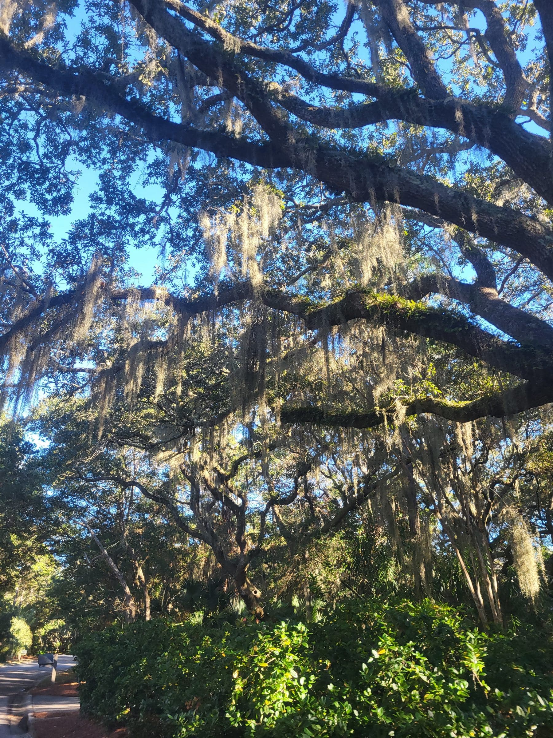
Live oaks and Spanish moss on Kiawah
Photo: JulDer Wiki, CC BY 4.0, via Wikimedia Commons (resized)
Two ways in
Talk it through with Mike, or ask Val — the guide’s AI assistant, answering from this site’s sourced facts.